
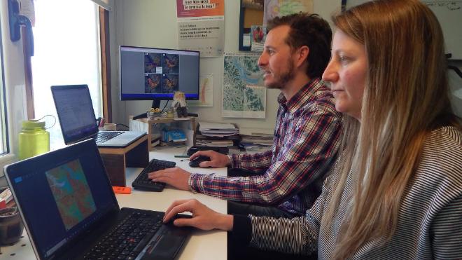
A CONICET research team at the Institute for Research in Cultural Diversity and Processes of Change (IIDyPCa, CONICET-UNRN) developed an innovative model that, for the first time, integrates the cost of moving by land and water to predict the routes used to move by ancient hunter-gatherer groups in Patagonia. This scientific advance, carried out by Federico L. Scartascini and Alhue Bay Gavuzzo, was recently published in the Journal of Archaeological Science.
“Navigation has been an important issue in the archaeology of the Nahuel Huapi for some years now,” explained Scartascini. According to the researcher, “the presence of direct or indirect evidence about this practice, such as the presence of monoxyl canoes on the lake (ancestral boats made from a log) or the human occupation of island sectors, made it possible to maintain that human groups had navigated the lake.” However, Scartascini recognized that “we did not have too many details of the modes, the routes or the temporality”.
Bay Gavuzzo explained that the traditional approach led to thinking about strategies only for terrestrial sectors, “leaving aquatic environments relegated or only signified as barriers.” In this way, the challenge was to map as a transition space from water to land and vice versa to allow mixed models.
Ancient water “highways” #
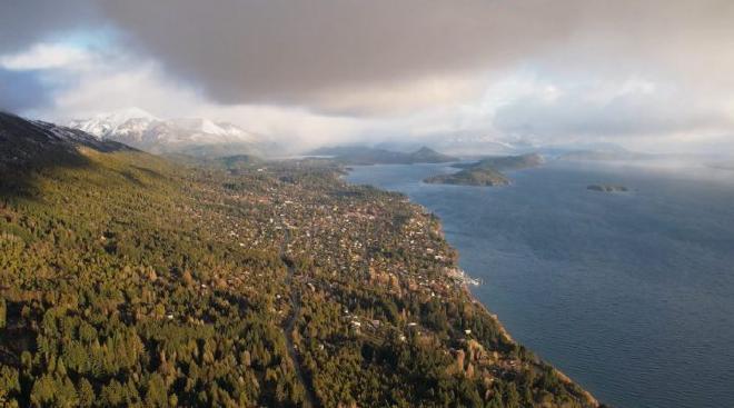
The study, entitled ‘Analysis of the Lowest Cost Route and River Navigation of Patagonian Hunter-Gatherers’, addresses the complex geography of the northern Patagonian Andes and its mixed landscape of mountains, forests, lakes and rivers.
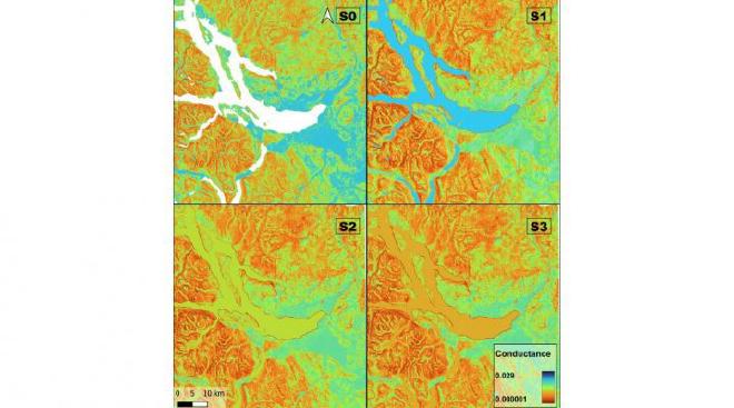
To understand how they moved in that landscapes, the specialists, through the use of the Least Cost Route Analysis (LCP), generated a georeferenced database of all the archaeological sites of the Nahuel Huapi National Park. From this information, they calculated the most efficient routes between the sites, the roads that would require less time and energy effort to travel from one place to another.
“The difficult thing was to assign a cost to that navigation in the past, so we found a job that assigns the same energy expenditure to walking with a backpack as to rowing with moderate effort and from this we generated four scenarios, in the first one you cannot navigate, and in the other three the cost of sailing is rising in relation to the slope areas. In addition, we validate the models with current routes,” said Bay Gavuzzo.
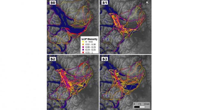
“The correspondence between the current and past routes validates our model in this sense, but above all it tells us that, as in the past, the cost variables that are weighted currently have to do, among other things, with the slope, the places protected from the prevailing winds, and with the most environmentally stable sectors,” Scartascini explained.
Routes from the past: key to future archaeological research #
“We are excited about the results we obtained because they allow us to understand navigation strategies in an environment of this type for the first time,” said Scartascini.
Citation #
- The study Least cost path analysis and fluvial navigation of Patagonian hunter-gatherers was published in the Journal of Archaeological Science. Authors: Federico L. Scartascini, Alhue Bay Gavuzzo.
Funding #
The writing of this paper has been supported by Universidad Nacional de Río Negro, Argentina (PI-UNRN 40-B-813) granted to FLS, and Agencia Nacional de Promoción de la Investigación, el Desarrollo Tecnológico y la Innovación, Argentina (Currently under extinction) (PICT-Serie A- 00577) granted to FLS.
Declaration of competing interest #
The authors declare the following financial interests/personal relationships which may be considered as potential competing interests: Federico L. Scartascini reports financial support, equipment, drugs, or supplies, and travel were provided by National University of Rio Negro. Federico L. Scartascini reports a relationship with National Scientific and Technical Research Council that includes: employment and funding grants.
Acknowledgments #
The researchers thanked Romina Braicovich, Oriana Hernández and F. Emmanuel Vargas with whom we discussed some of the initial ideas that motivated this article. We are also very grateful to the kayakers who participated in the construction of our participatory maps, especially Nicolás Cantini (Jonok Kayaks). We specially thank the editors of the special volume for accepting our article at the last minute. We also thank the División de Tecnología Informatica, Carem Project - CNEA, for their 256 GB, RAM server… (Sadly, Notaspampeanas has no full access to the PDF from the Journal of Archaeological Science because it’s has money cost. Sorry about that)
- The article Rutas ancestrales: nuevo estudio redefine la comprensión de la movilidad humana en la Patagonia was published in CONICET’s news section. It was written by Área de Comunicación CONICET Patagonia Norte
Contact [Notaspampeanas](mailto: notaspampeanas@gmail.com)